El Haras Urbanisation
Ica · Peru · 2017–2021
Technical data
- Client
- Centenario
- Type of intervention
- Urban planning and landscape
- Site area
- 416,052 m²
- Planned households
- 2,000+
- Period
- 2017–2021
- Status
- Built
Description
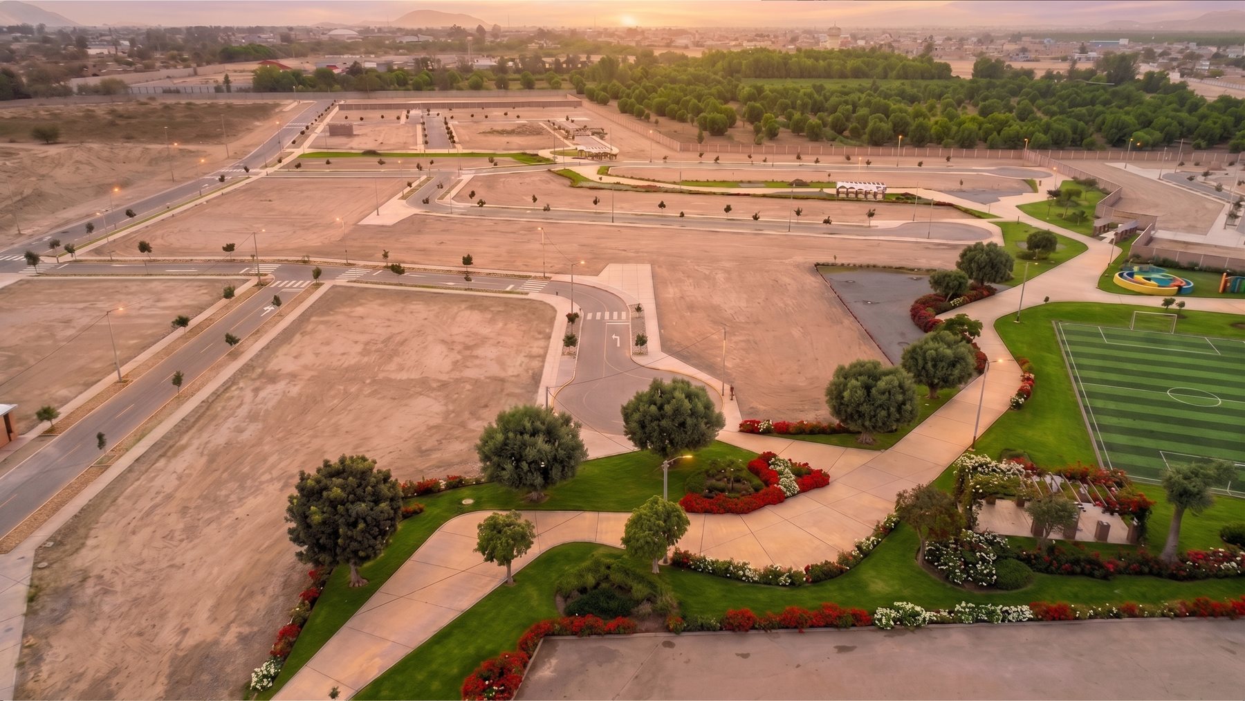
Ica is located on an agricultural valley parallel to the ocean. To the south of the city are the Ica dunes, which flank predominantly wine crops. In this area, right where the two main structural roads of the region meet, the land for the project is laid out.
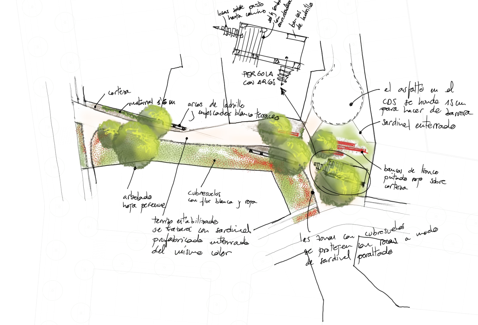
The urban approach has a longitudinal internal axis and two transversal connections that articulate the road flow with the regional streets and divide the land into four quadrants. Each of these quadrants is resolved by means of residential roads that allow the creation of small communities, fostering the relationship between neighbours. These lower-traffic roads are interrupted when they reach the park, generating greater continuity of the green spaces and integrating their design in order to improve their connection.
This network of parks creates an organic system that connects the entire development through a pedestrian circuit, along which spaces that host different activities appear. The park design traces paths that generate fluidity, based on the marks horses leave when trotting through the field. The geometry of the routes is supported by the arrangement of vegetation, public furniture and small hills that direct circulation; the trees are grouped into small groves that structure the space with sequences of full and empty, instilling a more rural character.
As a result, thanks to the prioritisation of the roads and the continuity of the green spaces, the development integrates into its surroundings and generates a functional, sustainable space that improves the quality of the place.